We will address these simple questions in tundra locations distributed throughout the Arctic to look for generality in these findings. Field site locations will span diverse light, moisture, and exposure regimes.
Contributing teams at each field site location should establish a minimum of three (or more if time permits) predominantly low-shrub (priority to Betula sp. and Salix sp. cover) and graminoid dominated tundra blocks (500 x 500m area). This extent is chosen to balance between the flight capabilities of various UAS and as an extent that is large enough to effectively compare with satellite-derived products of varying grains. We discuss tradeoffs in UAV platforms and sensors elsewhere in these documents, but acknowledge larger extents will be a goal for future seasons when hardware can be better standardized.
When selecting blocks, choose at least one that is relatively flat topographically, and at least one with some topographic relief, e.g. a drainage. Try to avoid areas with heavy human traffic over large portions of the site as this may impact vegetation conditions (via trampling). Also, consider selecting for areas that correspond with long-term ground measurements (value added) and/or areas that would be amenable to revisits and potential experimental manipulation in future seasons (like smaller scale herbivore exclosures).
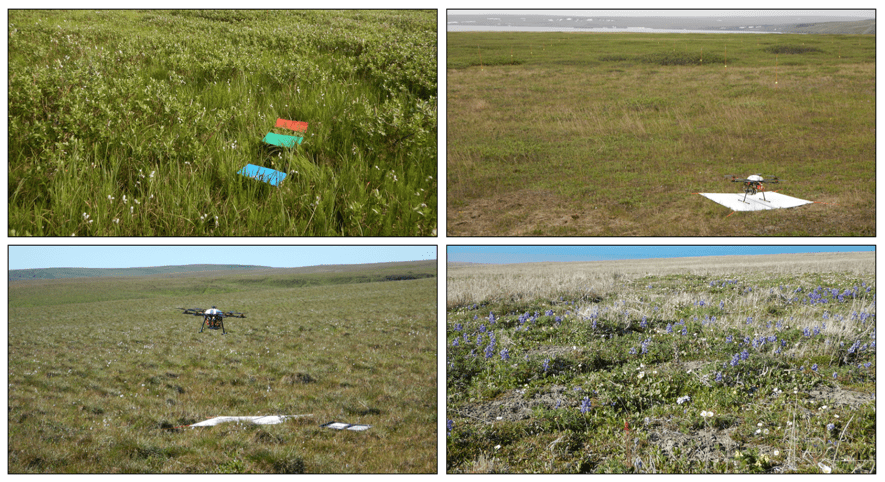
Make sure to mark the block corners with a semi-permanent/permanent marker before data collection, either with a Ground Control Point (GCP) marker, or even a cairn or landmark that can be easily identified from the air and will not move. Ideally, take a dGNSS (e.g. dGPS) point of these locations. If dGNSS capability is not available, a traditional handheld GPS/GNSS device can be used to record points these points using point averaging to increase the precision.